Good Heavens, California!

valley ranch

Garden Master
Joined
Dec 22, 2014
Messages
5,742
Reaction score
5,733
Points
367
Location
Sierra Nevada mountains, and Nevada high desert
That's it Steve "Swale" Thanks, couldn't think of the word.
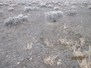
Here's a Swale, can't hardly see it without it being full of water~the ground is so saturated it wicks the water in. There is kinda of a rock called Caleachi. Gota go the girls and I are going to Fallon or
 

Attachments

  • IMG_0505.JPG
    IMG_0505.JPG
    339.9 KB · Views: 180
  • IMG_0506.JPG
    IMG_0506.JPG
    395 KB · Views: 193

ducks4you

Garden Master
Joined
Sep 4, 2009
Messages
12,131
Reaction score
16,684
Points
417
Location
East Central IL, Was Zone 6, Now...maybe Zone 5
I feel for everybody who is in danger. CA government has created many of these problems by not maintaining their reservoirs and dams both in Oroville and near San Diego. Guess some politicians wanted to buy votes with that money. =/
I think that CA needs to reevaluate their forest policies of "leaving habitat" in the form of dead wood, etc. It seems like a great idea, but during droughts it is dangerous tinder. THEN the burn leaves no vegetation, THEN the rain creates mudslides. These overarching "Forest Circus" policies need to be fine tuned. You CAN have some habitat, but not everywhere. The spotted owl WASN'T eradicated bc it had other habitats and has flourished, so THAT was a big, fat lie that made somebody out there some big money.
I remember a Weather Channel story a few years ago. This man had a house in the woods and he took it upon himself to clean up ALL of the pine needles around it bc he didn't like them there. Forest caught on fire and jumped HIS property bc of the lack of tinder. Won't happen everywhere, but cleanup is a must. There are just too many Americans who live in these areas to leave them totally wild. You can do that in the Canadian Rockies, but NOT here.
Also, in 1989 we vacationed with our horses in the Black Hills. There had been a big time drought there and forest fires, so we found ourselves in kind of a ghost campground, hardly anybody there. Turns out that the fires didn't burn everywhere. New growth was starting to emerge the next year. They, TOO, had left the dead debris as habitat, but they changed their policies. Now, in the summer they collect dead wood and pile it up, some sold as firewood, but piles are spread out. After a heavy snow the next winter, they burn the piles. It's working very well for them.
Prayers sent to the victims of the floods in CA.
 

digitS'

Garden Master
Joined
Dec 13, 2007
Messages
27,007
Reaction score
33,665
Points
457
Location
border, ID/WA(!)
Today, the Sacramento Bee has a look at the valley from the air. About 1 minute in, you begin to see some flooding of farmlands. By 4 minutes, I think we may all be wondering about the US food supply in 2017. It must be still early in the season but the Central Valley is a very flat place, especially near Sacramento. Many farm families must be having trouble getting in and out of their homes. The possibilities of flooding urban areas probably now is a real concern.

http://www.sacbee.com/news/state/california/water-and-drought/

The reservoirs that feed Lake Oroville were full a few days ago. Partly sunny and Sunny is the forecast for the remainder of the week for Sacramento. That looks like a very good thing.

Steve
 

so lucky

Garden Master
Joined
Mar 5, 2011
Messages
8,342
Reaction score
4,963
Points
397
Location
SE Missouri, Zone 6
But then I think I heard more storms and rain are in the forecast for next week.
I am already getting worried about our food supply. It seems that what doesn't come from California comes from Mexico, and that may start getting more expensive. It certainly will if scarcity in California plays into the picture, regardless of political issues. :hide
 

bobm

Garden Master
Joined
Aug 22, 2012
Messages
3,736
Reaction score
2,509
Points
307
Location
SW Washington
What they didn't show is the Yolo Causeway area. It starts just NW of Sacramento on I - 80 to near Davis, Cal. home of UC Davis, This area is a major floodplain that floods annually from the Sacramento River. Driving over the causeway on I-80 in the winter time floods it looks like the Ocean. It is a major water fowl stop for the migratory ducks and geese. Just N of Sacramento is one of the largest rice growing areas in this country. Rice patties as far as the eye can see in all directions that are flooded for half the year to grow rice. Just a few handfuls small towns and a farm house and rice silos to break the landscape of rice patties. Then oak covered rolling hills dotted with beef cows and sheep to the North and East. Recently almond orchards are replacing livestock. Port of Sacramento exports many shiploads of rice to the Far East.
 

digitS'

Garden Master
Joined
Dec 13, 2007
Messages
27,007
Reaction score
33,665
Points
457
Location
border, ID/WA(!)
Yolo was the name of my aunt and uncle county, in West Sac. They thought it was such a humorous name that they named a pug puppy they got from me, Yolo.

(The other pug puppy, I had already named Elizabeth ... yeah, I know. They called her Betsy, if I remember right. So, it was Betsy and Yolo, the Pugs :).)

Wheat for export trade, also. The big 3 ag products, although wheat is a little way down the list, wheat, corn and soybeans (MIT).

Steve
 

bobm

Garden Master
Joined
Aug 22, 2012
Messages
3,736
Reaction score
2,509
Points
307
Location
SW Washington
Steve, In Davis, Cal. there is a Hunt's tomato processing plant. They produce tomato paste, as their main product in 55 gal. drums that are exported to Japan by the shipload. Other popular exports are woodchips and sawdust that are shipped to Japan where they process them into Oriented Stand Board and particleboard, then ship these products back.
 

Latest posts

Top